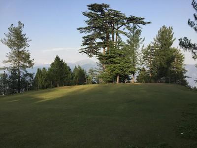
Kund Bangla
- Difficulty
- Hard
- Distance
- 18.2km
- Elevation gain
- 1,063 m
- Duration
- 7h
- Best season
- May – Oct
The journey
Kund Bangla is an 18.2km hard hike in Abbottabad. It climbs 1,063 m and takes about 7h.
Trail Statistics
Trail map
Elevation profile
Climb over the length of the trail. Tap or drag along it to read elevation and grade.
Weather
Five-day forecast at the trailhead, 1,374 m.
Today
17°17°
Precipitation 0.2
Tomorrow
25°13°
Precipitation 2
Fri
27°13°
Precipitation 0.1
Sat
26°12°
Sun
26°13°
Expect roughly 6°C colder at the high point (2,347 m), before wind chill. Mountain weather turns faster than any forecast.
Forecast from MET Norway, updated hourly.
Frequently asked questions
What colonial historical legacy is tied to Kund Bangla?
The rest house at the destination is a British-era structure constructed by the forest department in 1919 AD
Which massive historic trekking network does this trail connect to?
This path serves as the official starting point for the 66-kilometer-long British-era Munro Track.
What major valleys can be spotted simultaneously from the high ridges?
On a clear day, the trail offers sweeping panoramic views of both the Siran Valley and the Balakot (Kaghan) Valley
Is there any infrastructure available for overnight stays at the top?
While the old rest house has been undergoing reconstruction, hikers can camp at a managed facilitation center with washrooms located 2 kilometers before the summit
What is the primary surface composition of this specific trail?
The route is not a narrow foot track, but rather a rough dirt jeep road carved into the mountain ridge
Photos from hikers
Recent shots from the community on this trail
No community photos yet. Been here? Add the first one.
Reviews
Ratings and recent conditions from the community
No reviews yet. Hiked this trail? Be the first to share conditions and help other hikers.