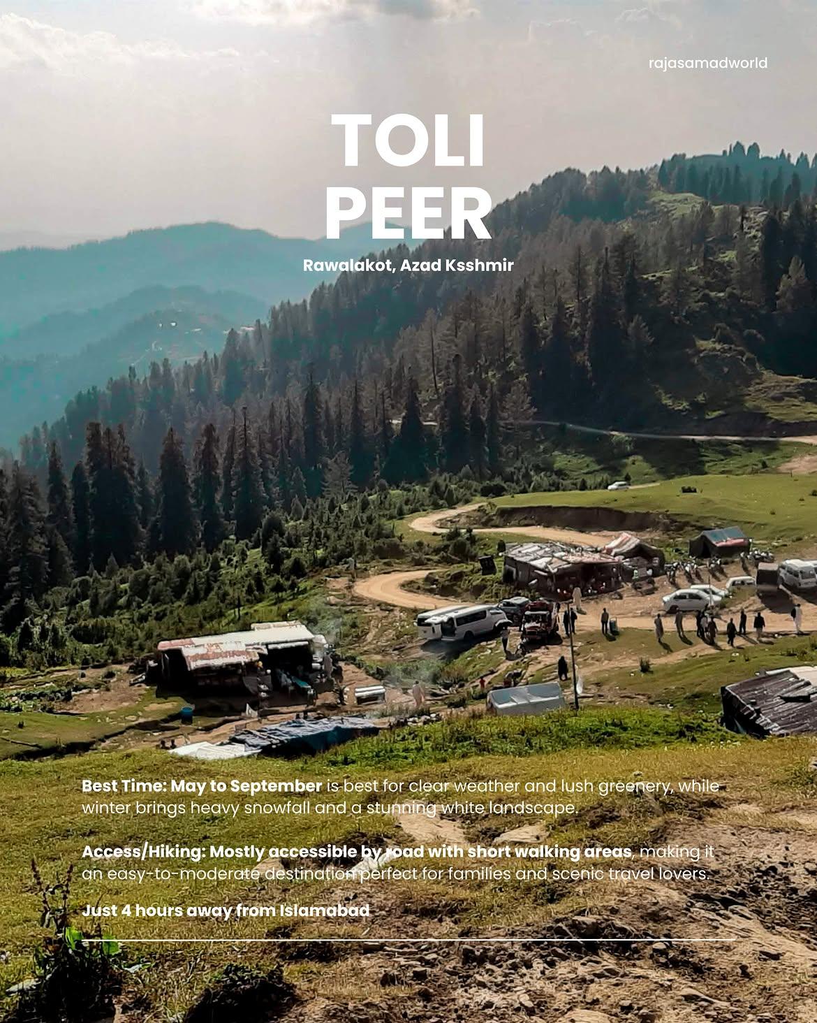
Toli Peer
Tolipeer is a majestic, high-altitude hilltop and expansive meadow plateau nestled in the Poonch District of Azad Kashmir. Standing at an elevation of approximately 2,680 meters (8,800 feet) above sea level, it is the highest peak in the Rawalakot region. The site is deeply famous for its rolling green hills, cool misty weather, and a small historical shrine located at the highest point of the ridge, making it a highly popular destination for camping and paragliding.
- Difficulty
- Easy
- Distance
- 1.4km
- Elevation gain
- 125 m
- Duration
- 18min
- Best season
- May – Oct
The journey
Toli Peer is a 1.4km easy hike near Rawalakot. It climbs 125 m and takes about 18min.
Tolipeer is a majestic, high-altitude hilltop and expansive meadow plateau nestled in the Poonch District of Azad Kashmir. Standing at an elevation of approximately 2,680 meters (8,800 feet) above sea level, it is the highest peak in the Rawalakot region. The site is deeply famous for its rolling green hills, cool misty weather, and a small historical shrine located at the highest point of the ridge, making it a highly popular destination for camping and paragliding.
Trail Statistics
Trail map
Elevation profile
Climb over the length of the trail. Tap or drag along it to read elevation and grade.
Weather
Five-day forecast at the trailhead, 2,572 m.
Today
10°7°
Tomorrow
18°7°
Precipitation 1.4
Sat
18°10°
Precipitation 0.4
Sun
18°11°
Precipitation 1
Mon
19°11°
Precipitation 0.8
Forecast from MET Norway, updated hourly.
Frequently asked questions
Is Toli Peer suitable for beginners?
Yes, the summit area is accessible without technical hiking skills.
Can you reach the trailhead by car or is 4×4 required?
The summit road is generally accessible by passenger cars, though poor road conditions can make higher-clearance vehicles preferable.
Is Toli Peer well-marked?
The main route to the summit is straightforward, but trail navigation can be less defined away from the main access road.
Is camping possible?
Yes, camping is possible around the Toli Peer area.
When is Toli Peer inaccessible?
Heavy rain, mud and poor road conditions can make the summit road difficult or unsafe.
Why is it called Toli Peer?
Local folklore connects the name with saints Said Pir and Golara Shah who are believed to have meditated in the area.
Trail gallery
Trail Photos
Photos from hikers
Recent shots from the community on this trail
No community photos yet. Been here? Add the first one.
Reviews
Ratings and recent conditions from the community
- KkussboiHiked Sep 9, 2026
Sexfull