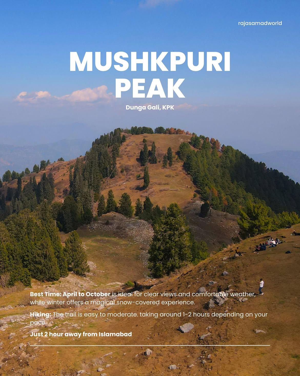
Mushkpuri Top
The Mushkpuri Top (also spelled Mukshpuri) is the second-highest mountain peak in the scenic Galyat Region of the Ayubia National Park after Miranjani top. Translating beautifully to the "city of musk," this legendary trail is exceptionally popular among families, beginners and photography enthusiasts due to its vibrant, alpine meadows and dense subalpine forests.
- Difficulty
- Moderate
- Distance
- 5.2km
- Elevation gain
- 69 m
- Duration
- 2h
- Best season
- May – Oct
The journey
Mushkpuri Top is a 5.2km moderate hike near Dunga Gali. It climbs 69 m and takes about 2h.
The Mushkpuri Top (also spelled Mukshpuri) is the second-highest mountain peak in the scenic Galyat Region of the Ayubia National Park after Miranjani top. Translating beautifully to the "city of musk," this legendary trail is exceptionally popular among families, beginners and photography enthusiasts due to its vibrant, alpine meadows and dense subalpine forests.
Trail Statistics
Trail map
Elevation profile
Climb over the length of the trail. Tap or drag along it to read elevation and grade.
Weather
Five-day forecast at the trailhead, 2,385 m.
Today
10°10°
Tomorrow
20°9°
Precipitation 0.6
Sat
21°11°
Precipitation 0.1
Sun
20°11°
Precipitation 0.5
Mon
21°11°
Precipitation 0.3
Forecast from MET Norway, updated hourly.
Frequently asked questions
Is Mushkpuri suitable for beginners?
Yes, it is a popular hike and does not require technical climbing skills.
Can you reach the trailhead by car?
Yes, the main trailheads at Dunga Gali and Nathia Gali are accessible by road.
Is the trail well-marked?
Yes, the main routes to Mushkpuri are established and commonly used.
Is mobile signal available?
Coverage can be weak in places, so downloading an offline map is advisable.
Is drinking water available?
Water should not be relied upon along the trail; carry sufficient drinking water.
Is camping possible?
Camping is possible in the surrounding area, but hikers should use appropriate designated/private camping locations.
When is Mushkpuri inaccessible?
Heavy snowfall can make the trail difficult during winter; snow conditions should be checked before hiking.
Why is it called Mushkpuri?
The name is commonly linked to musk and puri, interpreted as “place of musk.”
Trail gallery
Trail Photos
Photos from hikers
Recent shots from the community on this trail
No community photos yet. Been here? Add the first one.
Reviews
Ratings and recent conditions from the community
No reviews yet. Hiked this trail? Be the first to share conditions and help other hikers.