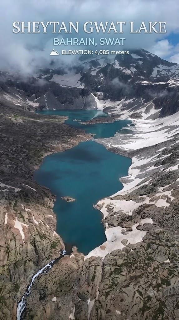
Sheytaan Gwat Lake
Sheytaan Gwat Lake is a 11.4 km trek in the Swat & Kalam region of northern Pakistan with around 529 m of elevation gain.
- Difficulty
- Hard
- Distance
- 11.4km
- Elevation gain
- 682 m
- Duration
- 4h
- Best season
- May – Oct
The journey
Sheytaan Gwat Lake is an 11.4km hard hike in Swat & Kalam. It climbs 682 m and takes about 4h.
Sheytaan Gwat Lake is a 11.4 km trek in the Swat & Kalam region of northern Pakistan with around 529 m of elevation gain.
Trail Statistics
Trail map
Elevation profile
Climb over the length of the trail. Tap or drag along it to read elevation and grade.
Weather
Five-day forecast at the trailhead, 3,839 m.
Today
-3°-3°
Tomorrow
7°-3°
Precipitation 3.3
Sat
10°-1°
Precipitation 0.9
Sun
10°0°
Precipitation 1.4
Mon
12°0°
Precipitation 0.5
Expect roughly 4°C colder at the high point (4,457 m), before wind chill. Mountain weather turns faster than any forecast.
Forecast from MET Norway, updated hourly.
Frequently asked questions
What makes Sheytaan Gwat Lake different from other alpine lakes?
Three things: the water is mirror-flat and clear enough that the peaks read as a reflection, the approach is a long steep walk rather than the roadside stop most Swat lakes are, and it carries more folklore than any of them. Shepherds call it the Devil's Corner, and tell of a golden bowl on the lake bed that only the pious can see.
Is the lake actually filled with water throughout the year?
Yes, it is pretty huge lake and freezs in winter.
What is the altitude of Shaitan Gwat Lake?
It sits at approximately 13,404 to 13,500 feet (4,080 meters) above sea level.
How long is the trek to the lake?
The trek is strenuous and takes about 12 to 15 hours one way, often split into a two-day journey depending on your physical endurance and pace.
Why is it called Shaitan Gwat?
Local shepherds traditionally named it "Devil's Corner" due to the rugged, isolated nature of the steep terrain and local folklore.
Are there hotels or guesthouses on the route?
None at all
Trail gallery
Trail Photos
Photos from hikers
Recent shots from the community on this trail
No community photos yet. Been here? Add the first one.
Reviews
Ratings and recent conditions from the community
No reviews yet. Hiked this trail? Be the first to share conditions and help other hikers.