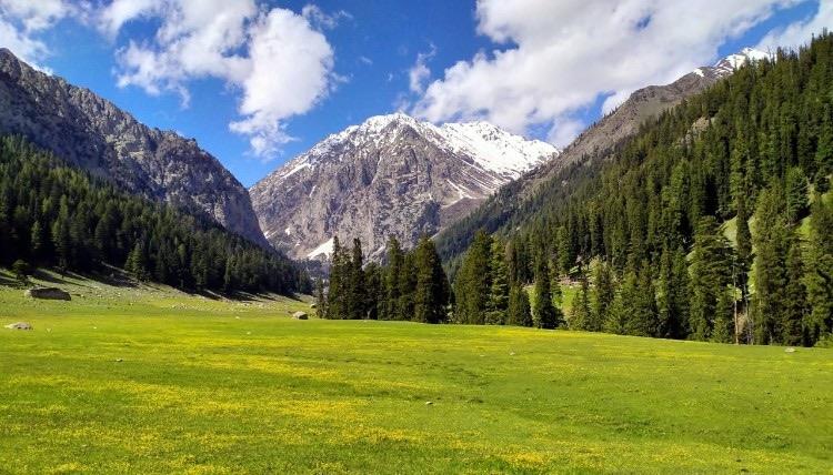
Janshai Meadows
Janshai Meadows is a 7 km trek in the Swat & Kalam region of northern Pakistan with around 586 m of elevation gain.
- Difficulty
- Moderate
- Distance
- 7.0km
- Elevation gain
- 609 m
- Duration
- 3h
- Best season
- May – Oct
The journey
Janshai Meadows is a 7.0km moderate hike in Swat & Kalam. It climbs 609 m and takes about 3h.
Janshai Meadows is a 7 km trek in the Swat & Kalam region of northern Pakistan with around 586 m of elevation gain.
Trail Statistics
Trail map
Elevation profile
Climb over the length of the trail. Tap or drag along it to read elevation and grade.
Weather
Five-day forecast at the trailhead, 2,223 m.
Today
7°7°
Tomorrow
18°6°
Precipitation 1.3
Sat
21°5°
Precipitation 0.1
Sun
21°6°
Precipitation 1.4
Mon
22°6°
Precipitation 0.6
Expect roughly 3°C colder at the high point (2,750 m), before wind chill. Mountain weather turns faster than any forecast.
Forecast from MET Norway, updated hourly.
Frequently asked questions
What is unique about this meadow?
Janshai serves as a crucial transit and base area for trekkers heading deeper into the high-altitude wilderness toward Andrab Lake (also known as Andrap/Kooh Lake) and Mastij Lake.
How steep is the initial climb out of the valley?
The trail begins with a mild incline but turns into a demanding, steep hike for about 30 minutes before entering the forest zone.
What kind of accommodation is available at the top?
There are no hotels or regular guest houses; self-camping with your own tent and gear is mandatory.
What is the elevation profile of Janshai
You will be ascending to a high altitude of roughly 2,796 to 3,188 metres
Is there a commercial food source at the meadows?
No, you must pack all your own raw food, stove, and fuel as there are no active tuck shops at the top.
Photos from hikers
Recent shots from the community on this trail
No community photos yet. Been here? Add the first one.
Reviews
Ratings and recent conditions from the community
No reviews yet. Hiked this trail? Be the first to share conditions and help other hikers.