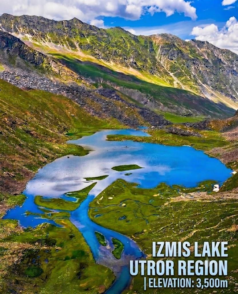
Izmis Lake
Izmis Lake is a 8.8 km trek in the Swat & Kalam region of northern Pakistan with around 485 m of elevation gain.
- Difficulty
- Moderate
- Distance
- 8.8km
- Elevation gain
- 352 m
- Duration
- 3h
- Best season
- May – Oct
The journey
Izmis Lake is an 8.8km moderate hike in Swat & Kalam. It climbs 352 m and takes about 3h.
Izmis Lake is a 8.8 km trek in the Swat & Kalam region of northern Pakistan with around 485 m of elevation gain.
Trail Statistics
Trail map
Elevation profile
Climb over the length of the trail. Tap or drag along it to read elevation and grade.
Weather
Five-day forecast at the trailhead, 3,317 m.
Today
2°1°
Tomorrow
11°2°
Precipitation 3.4
Sat
14°4°
Precipitation 0.9
Sun
14°5°
Precipitation 0.7
Mon
15°5°
Precipitation 0.2
Forecast from MET Norway, updated hourly.
Frequently asked questions
What is the trail surface and terrain like?
Rocky moraines and alpine mud trails dominate the route, requiring ankle-support boots.
Can you drive directly to the trailhead?
No, a 4x4 jeep goes only as far as Loypanrghalay/Utror pastures, followed by a mandatory 3-to-5-hour trek.
Are there established campsites or shepherd shelters?
Basic stone shepherd huts exist near the lake periphery, but carrying self-sufficient four-season tents is required.
Why is the lake called Izmis?
The name translates to "caves" in the indigenous Kohistani dialect due to the limestone hollows encircling it.
What makes the ecology around Izmis Lake unique?
The area surrounding the lake features specialized high-altitude alpine wetlands. These wetlands include unique peat-land marshes that are rare for the region.
Photos from hikers
Recent shots from the community on this trail
No community photos yet. Been here? Add the first one.
Reviews
Ratings and recent conditions from the community
No reviews yet. Hiked this trail? Be the first to share conditions and help other hikers.