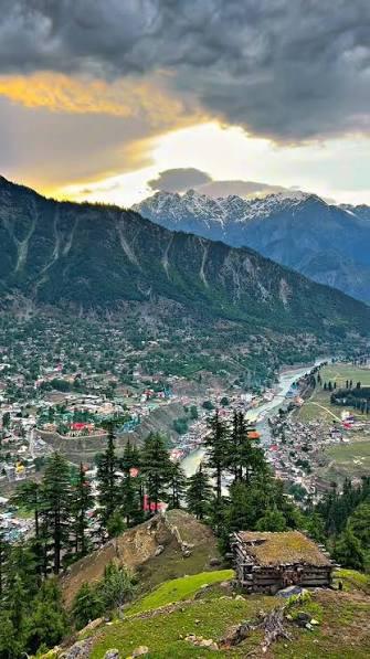
Boyun Top
Boyun Top is a 3.7 km trek in the Swat & Kalam region of northern Pakistan with around 543 m of elevation gain.
- Difficulty
- Moderate
- Distance
- 3.7km
- Elevation gain
- 499 m
- Duration
- 2h
- Best season
- May – Oct
The journey
Boyun Top is a 3.7km moderate hike in Swat & Kalam. It climbs 499 m and takes about 2h.
Boyun Top is a 3.7 km trek in the Swat & Kalam region of northern Pakistan with around 543 m of elevation gain.
Trail Statistics
Trail map
Elevation profile
Climb over the length of the trail. Tap or drag along it to read elevation and grade.
Weather
Five-day forecast at the trailhead, 1,962 m.
Today
9°8°
Tomorrow
20°7°
Precipitation 1.3
Sat
23°7°
Precipitation 0.1
Sun
23°8°
Precipitation 1.4
Mon
23°8°
Precipitation 0.6
Forecast from MET Norway, updated hourly.
Frequently asked questions
Can a standard sedan drive all the way to Boyun Top?
No, the steep, rutted dirt track from Kalam requires high-clearance 4x4 jeeps or a 2 to 3-hour hike.
Is the hiking route shaded against the sun?
The early trail climbs through dense pine canopy, but the upper plateau is fully exposed pastureland.
Are meals or snacks available at the top?
Only a few seasonal, basic tea stalls operate at the viewpoint during peak summer so carry your own rations.
Can you camp overnight on Boyun Top?
Yes, wild camping is possible on the grassy meadows, but you must pack in your own water and windbreaks.
What is the main directional view from the summit?
It gives an unobstructed birds-eye view overlooking Kalam Valley, the Ushu River confluence, and distant snow peaks like Falaksar.
Photos from hikers
Recent shots from the community on this trail
No community photos yet. Been here? Add the first one.
Reviews
Ratings and recent conditions from the community
No reviews yet. Hiked this trail? Be the first to share conditions and help other hikers.