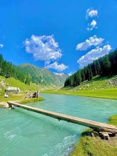
Jahaz Banda To Kund Banda
Jahaz Banda To Kund Banda is a 6.9 km trek in the Kumrat Valley region of northern Pakistan with around 384 m of elevation gain.
- Difficulty
- Easy
- Distance
- 6.9km
- Elevation gain
- 352 m
- Duration
- 2h
- Best season
- May – Oct
The journey
Jahaz Banda To Kund Banda is a 6.9km easy out-and-back hike in Kumrat Valley. It climbs 352 m and takes about 2h.
Jahaz Banda To Kund Banda is a 6.9 km trek in the Kumrat Valley region of northern Pakistan with around 384 m of elevation gain.
Trail Statistics
Trail map
Elevation profile
Climb over the length of the trail. Tap or drag along it to read elevation and grade.
Weather
Five-day forecast at the trailhead, 2,997 m.
Today
4°4°
Tomorrow
14°4°
Precipitation 1.5
Sat
16°6°
Precipitation 0.3
Sun
16°6°
Precipitation 0.4
Mon
17°7°
Forecast from MET Norway, updated hourly.
Frequently asked questions
How long does it take to hike between these two meadows?
There are two routes but the downhill one is a short trek of around 30-50 minutes.
What is the directional slope of this specific trail?
The trail goes predominantly downhill from Jahaz Banda, descending into a peaceful, lower valley.
What is the primary landmark to look for at Kund Banda?
The meadow is famous for its winding Snake River and a picturesque waterfall.
Is this route suitable for children and older family members?
Yes, because the distance is short, it is highly doable for families who want a break from the steeper Katora trail.
s horse riding an option for this specific section?
Yes, local horses can be hired at Jahaz Banda to take you down if you want to avoid walking.
Photos from hikers
Recent shots from the community on this trail
No community photos yet. Been here? Add the first one.
Reviews
Ratings and recent conditions from the community
No reviews yet. Hiked this trail? Be the first to share conditions and help other hikers.