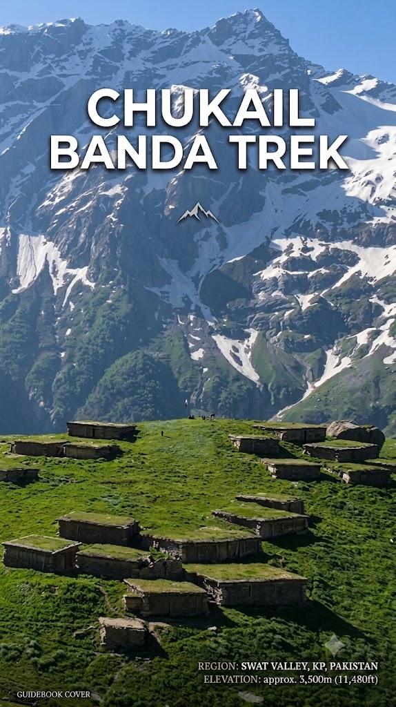
Chukail Banda
Chukail Banda is a 2.6 km trek in the Swat & Kalam region of northern Pakistan with around 880 m of elevation gain.
- Difficulty
- Moderate
- Distance
- 2.6km
- Elevation gain
- 643 m
- Duration
- 2h
- Best season
- May – Oct
The journey
Chukail Banda is a 2.6km moderate hike in Swat & Kalam. It climbs 643 m and takes about 2h.
Chukail Banda is a 2.6 km trek in the Swat & Kalam region of northern Pakistan with around 880 m of elevation gain.
Trail Statistics
Trail map
Elevation profile
Climb over the length of the trail. Tap or drag along it to read elevation and grade.
Weather
Five-day forecast at the trailhead, 2,609 m.
Today
6°5°
Tomorrow
15°3°
Precipitation 0.9
Sat
17°5°
Sun
16°6°
Precipitation 0.9
Mon
18°6°
Precipitation 0.3
Expect roughly 4°C colder at the high point (3,236 m), before wind chill. Mountain weather turns faster than any forecast.
Forecast from MET Norway, updated hourly.
Frequently asked questions
Is a 4×4 needed to reach the Chukail Banda trailhead?
The rough Mankial–Kamar Khwa road is best tackled with a capable 4×4.
Does the hike pass through forest before reaching the meadows?
Yes, the route climbs through deodar and pine forest before opening into Chukail Banda.
Can you camp at Chukail Banda?
Yes, the open meadows are suitable for overnight camping, particularly during the trekking season.
Can you reach Chukail Banda using public transport alone?
Public transport can get you to Mankial, but the onward approach to Kamar Khwa requires suitable off-road transport.
Any other hike near chukail banda?
Other nearby hikes include Taip Banda, Jaba Meadows, and Palanchai Meadows, with Jabba Waterfall located right along the connecting Jaba trail network.
Photos from hikers
Recent shots from the community on this trail
No community photos yet. Been here? Add the first one.
Reviews
Ratings and recent conditions from the community
No reviews yet. Hiked this trail? Be the first to share conditions and help other hikers.