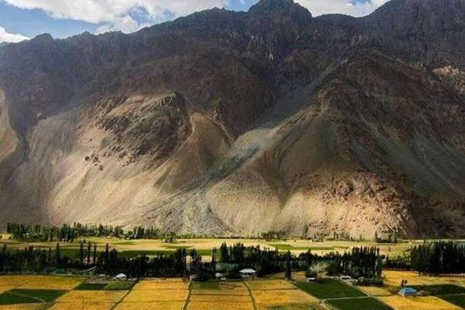
Makuli Meadows
- Difficulty
- Easy
- Distance
- 8.2km
- Elevation gain
- 215 m
- Duration
- 3h
- Best season
- Jun – Sep
The journey
Makuli Meadows is an 8.2km easy hike in Ghizer Valley. It climbs 215 m and takes about 3h.
Trail Statistics
Trail map
Elevation profile
Climb over the length of the trail. Tap or drag along it to read elevation and grade.
Weather
Five-day forecast at the trailhead, 3,182 m.
Today
8°3°
Precipitation 9.1
Tomorrow
11°1°
Sat
14°3°
Sun
14°6°
Precipitation 0.6
Mon
14°6°
Precipitation 0.2
Forecast from MET Norway, updated hourly.
Frequently asked questions
Where does the trek to Makuli Meadows begin?
The Makuli Meadows Trek starts in Qurqulti village in the Yasin Valley of the Ghizer District in Gilgit-Baltistan, Pakistan
Can I camp overnight at Makuli Meadows?
Yes, the open meadows are ideal for wild camping, but you must bring all your own tents, food, and gear.
Is there mobile network coverage at the meadows?
No, cellular signals generally drop out once you trek deeper into the valley past the main villages.
Can I rent horses or porters for the trek?
Yes, you can arrange for local porters or pack animals through village elders in the nearby settlements before starting.
Where is the last place to buy food supplies?
You should purchase all your food rations, water, and emergency supplies in Taus or the main Yasin Bazar.
Trail gallery
Trail Photos
Photos from hikers
Recent shots from the community on this trail
No community photos yet. Been here? Add the first one.
Reviews
Ratings and recent conditions from the community
No reviews yet. Hiked this trail? Be the first to share conditions and help other hikers.