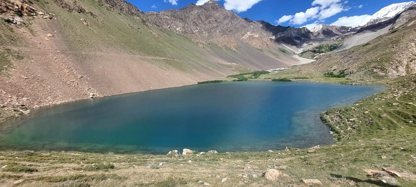
Khalter Lake
Khalter Lake is a 5.2 km trek in the Ghizer Valley region of northern Pakistan with around 879 m of elevation gain.
- Difficulty
- Moderate
- Distance
- 5.2km
- Elevation gain
- 879 m
- Duration
- 3h
- Best season
- Jun – Sep
The journey
Khalter Lake is a 5.2km moderate hike in Ghizer Valley. It climbs 879 m and takes about 3h.
Khalter Lake is a 5.2 km trek in the Ghizer Valley region of northern Pakistan with around 879 m of elevation gain.
Trail Statistics
Trail map
Elevation profile
Climb over the length of the trail. Tap or drag along it to read elevation and grade.
Weather
Five-day forecast at the trailhead, 3,007 m.
Today
3°-3°
Precipitation 0.2
Tomorrow
4°-8°
Thu
4°-5°
Fri
3°-9°
Precipitation 0.1
Sat
1°-11°
Expect roughly 6°C colder at the high point (3,887 m), before wind chill. Mountain weather turns faster than any forecast.
Forecast from MET Norway, updated hourly.
Frequently asked questions
Tell me about the trailhead
The trailhead begins at Darkut Village, the final settlement of the Yasin Valley
What is the altitude of the lake?
It is at approximately 12,750 feet (3,887 meters)
What terrain should I expect around Khalter Lake?
Expect rugged alpine terrain where weather and seasonal snow can significantly change trail conditions.
Is camping possible near Khalter Lake?
Remote lake routes generally require self-supported camping if an overnight itinerary is planned.
Should I carry my own food and emergency supplies?
Yes, particularly because remote alpine destinations may have no shops or permanent facilities nearby.
Photos from hikers
Recent shots from the community on this trail
No community photos yet. Been here? Add the first one.
Reviews
Ratings and recent conditions from the community
No reviews yet. Hiked this trail? Be the first to share conditions and help other hikers.