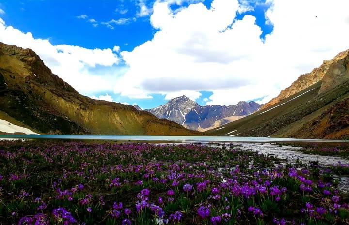
Assombar Lake
- Difficulty
- Expert
- Distance
- 19.6km
- Elevation gain
- 1,630 m
- Duration
- 8h
- Best season
- Jun – Sep
The journey
Assombar Lake is a 19.6km expert-level hike in Ghizer Valley. It climbs 1,630 m and takes about 8h.
Trail Statistics
Trail map
Elevation profile
Climb over the length of the trail. Tap or drag along it to read elevation and grade.
Weather
Five-day forecast at the trailhead, 2,440 m.
Today
10°7°
Precipitation 1
Tomorrow
16°6°
Sat
20°8°
Sun
19°11°
Precipitation 0.3
Mon
19°10°
Precipitation 0.4
Expect roughly 10°C colder at the high point (4,055 m), before wind chill. Mountain weather turns faster than any forecast.
Forecast from MET Norway, updated hourly.
Frequently asked questions
Where does the trek to Assombar Lake physically originate?
It starts from Asumbar village in Ishkoman Valley, following the Asumbar Nala upstream into the high pasture basin.
Can Assombar Lake be visited as part of a pass crossing?
Yes, it lies within the alpine basin directly linked to the classic Asumbar Haghost (Asumbar Pass) route to Dal Sandhi in Yasin
What is the elevation profile around Assombar Lake?
The maximum height reached around the Assombar Lake trail area is approximately 4,680 meters (15,354 feet) above sea level at the Asumbar Pass / Punji Pass summit
What distinct cultural element is noticeable among local shepherds in this valley?
The pasture trails form a unique linguistic corridor where Wakhi, Khowar, Burushaski, and Shina speaking herders intersect
Is there any mobile phone connectivity anywhere near Assombar Lake?
No cellular signals reach into the inner Asumbar gorge; satellite tracking or offline maps are strictly required.
Photos from hikers
Recent shots from the community on this trail
No community photos yet. Been here? Add the first one.
Reviews
Ratings and recent conditions from the community
No reviews yet. Hiked this trail? Be the first to share conditions and help other hikers.