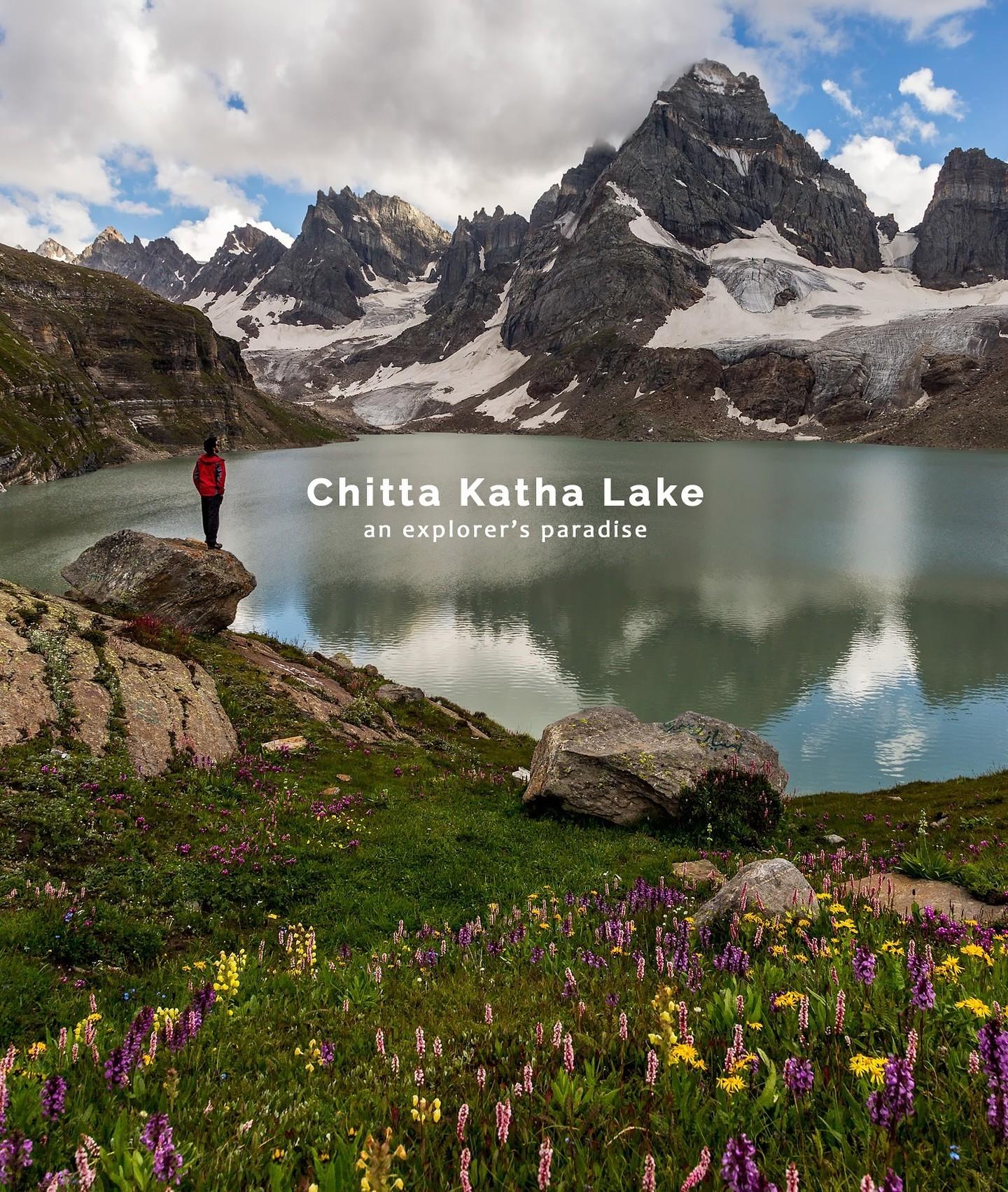
Chitta Katha Lake
Chitta Katha Lake is a breathtaking, sacred high-altitude alpine gem cradled in the Shounter Valley of Azad Kashmir, Pakistan. Sitting at an elevation of 13,500 feet (4,100 meters), this stunning lake is enclosed by the dramatic, jagged ridges of Hari Parbat. It is widely celebrated for its pristine, shifting turquoise and emerald green waters, as well as the massive glacier fields that cascade directly into its basin.
- Difficulty
- Hard
- Distance
- 9.5km
- Elevation gain
- 1,345 m
- Duration
- 9h
- Best season
- Jun – Sep
The journey
Chitta Katha Lake is a 9.5km hard hike in Neelum Valley. It climbs 1,345 m and takes about 9h.
Chitta Katha Lake is a breathtaking, sacred high-altitude alpine gem cradled in the Shounter Valley of Azad Kashmir, Pakistan. Sitting at an elevation of 13,500 feet (4,100 meters), this stunning lake is enclosed by the dramatic, jagged ridges of Hari Parbat. It is widely celebrated for its pristine, shifting turquoise and emerald green waters, as well as the massive glacier fields that cascade directly into its basin.
Trail Statistics
Trail map
Elevation profile
Climb over the length of the trail. Tap or drag along it to read elevation and grade.
Weather
Five-day forecast at the trailhead, 2,785 m.
Today
7°2°
Tomorrow
12°1°
Precipitation 1.2
Sat
16°1°
Precipitation 0.6
Sun
16°3°
Precipitation 1.7
Mon
16°3°
Precipitation 2.1
Expect roughly 8°C colder at the high point (4,067 m), before wind chill. Mountain weather turns faster than any forecast.
Forecast from MET Norway, updated hourly.
Frequently asked questions
Do you need a jeep before starting the Chitta Katha Lake trek?
Yes, the usual approach involves a rough jeep journey from Kel toward the basecamp (Domail Bala or Hoz)
Where do most trekkers camp before Chitta Katha Lake?
Dak-1 and Dak-2 are established camping points used along the approach with Dak-3 being the last..
Can the trail become difficult after rain?
Yes, rain can make the already rocky and steep sections considerably more difficult to negotiate.
Are guides or porters available for Chitta Katha Lake?
Guides and porters can be arranged from places such as Houz, Dak-1 and Dak-2.
Is camping directly beside Chitta Katha Lake practical?
Camping is possible in some spots, but many itineraries use lower camps because conditions near the lake can be cold and foggy.
Photos from hikers
Recent shots from the community on this trail
No community photos yet. Been here? Add the first one.
Reviews
Ratings and recent conditions from the community
No reviews yet. Hiked this trail? Be the first to share conditions and help other hikers.