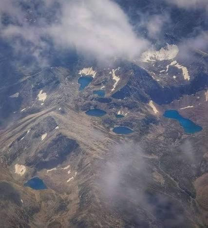
Satsar Mala
Satsar Mala is a 4.3 km trek in the Naran & Kaghan region of northern Pakistan with around 718 m of elevation gain.
- Difficulty
- Moderate
- Distance
- 4.3km
- Elevation gain
- 666 m
- Duration
- 2h
- Best season
- Jun – Sep
The journey
Satsar Mala is a 4.3km moderate hike in Mansehra. It climbs 666 m and takes about 2h.
Satsar Mala is a 4.3 km trek in the Naran & Kaghan region of northern Pakistan with around 718 m of elevation gain.
Trail Statistics
Trail map
Elevation profile
Climb over the length of the trail. Tap or drag along it to read elevation and grade.
Weather
Five-day forecast at the trailhead, 3,621 m.
Today
6°1°
Precipitation 0.9
Tomorrow
8°-1°
Precipitation 4.8
Sat
11°-3°
Precipitation 1.4
Sun
12°0°
Precipitation 2
Mon
13°-1°
Precipitation 1.3
Expect roughly 4°C colder at the high point (4,290 m), before wind chill. Mountain weather turns faster than any forecast.
Forecast from MET Norway, updated hourly.
Frequently asked questions
What is Satsar Mala known for?
It is a high-altitude alpine plateau featuring a chain of seven glacial lakes.
Where does the trek to Satsar Mala begin?
The trek generally starts from Gitidas or near Babusar Pass on the N-15 highway.
Do hikers need cold-weather gear in summer?
Yes, night temperatures frequently drop near freezing, requiring thermal layers and 4-season tents.
Is a local guide required for this route?
Yes, a local guide is strongly advised due to unpredictable weather, lack of trail markers, and high-altitude terrain.
Photos from hikers
Recent shots from the community on this trail
No community photos yet. Been here? Add the first one.
Reviews
Ratings and recent conditions from the community
No reviews yet. Hiked this trail? Be the first to share conditions and help other hikers.