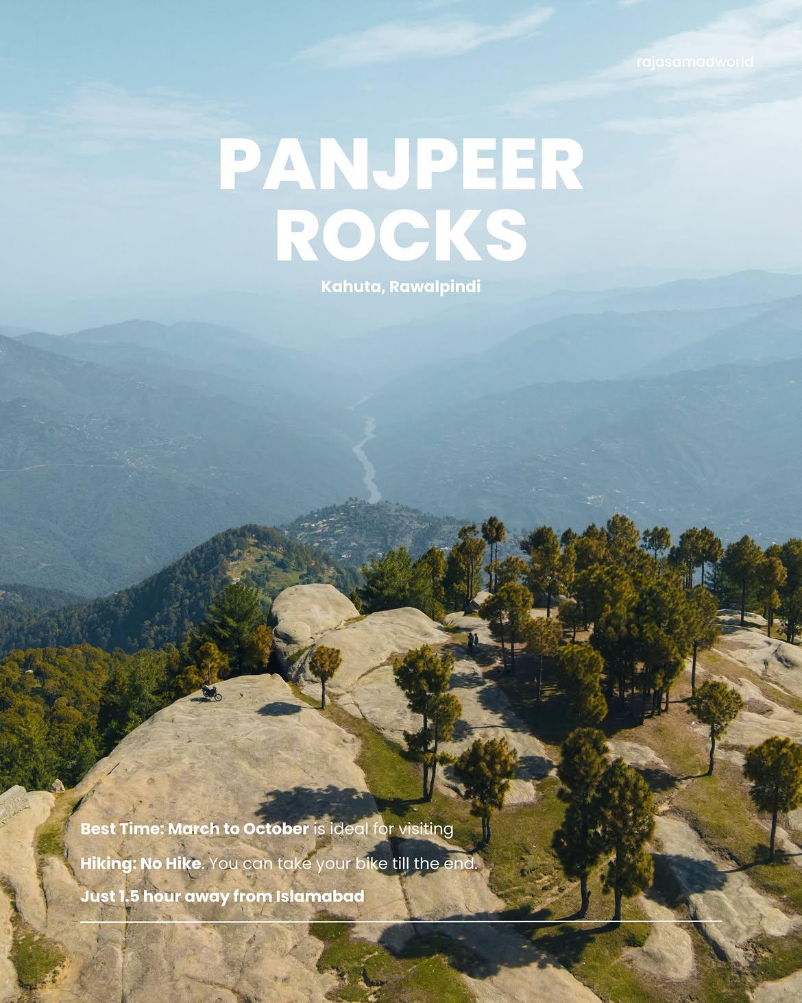
Panjpeer Rocks
The Panjpeer Rocks (also known as the Balcony of Potohar) is a breathtaking, rugged geological wonder perched on the highest point of the Danoi Ridge in the Kotli Sattian / Kahuta region. Standing at an elevation of nearly 5,700 feet, this unique backcountry route features massive, ancient sandstone slabs stacked like natural terraces and is deeply tied to local folklore about five mystics (Panj Peers) who once meditated there.
- Difficulty
- Moderate
- Distance
- 7.6km
- Elevation gain
- 647 m
- Duration
- 2h
- Best season
- Oct – Apr
The journey
Panjpeer Rocks is a 7.6km moderate hike near Kotli Sattian. It climbs 647 m and takes about 2h.
The Panjpeer Rocks (also known as the Balcony of Potohar) is a breathtaking, rugged geological wonder perched on the highest point of the Danoi Ridge in the Kotli Sattian / Kahuta region. Standing at an elevation of nearly 5,700 feet, this unique backcountry route features massive, ancient sandstone slabs stacked like natural terraces and is deeply tied to local folklore about five mystics (Panj Peers) who once meditated there.
Trail Statistics
Trail map
Ways up
3 recorded routes to the same place. Pick the one that suits the day you have.
| Route | Distance | Ascent | Time | Grade |
|---|---|---|---|---|
| Short | 3.3km | +40m | 54min | Easy |
| Long | 7.6km | +647m | 3h | Moderate |
| Ridge | 10.1km | +149m | 3h | Hard |
Elevation profile
Climb over the length of the trail. Tap or drag along it to read elevation and grade.
Weather
Five-day forecast at the trailhead, 945 m.
Today
26°19°
Tomorrow
28°17°
Sat
29°17°
Sun
28°18°
Mon
28°17°
Expect roughly 4°C colder at the high point (1,551 m), before wind chill. Mountain weather turns faster than any forecast.
Forecast from MET Norway, updated hourly.
Frequently asked questions
What makes Panjpeer Rocks unique?
The site features dramatic, fractured sandstone rock formations, sheer cliff drops, and views of the Jhelum River.
How do you access the trailhead?
Take the road from Kahuta up toward Narh village, from where the walking trail begins.
Can standard passenger cars reach the base?
Low-clearance cars can reach lower Narh, but high-clearance vehicles or bikes are better for the rough approach road.
Is Panjpeer safe for overnight camping?
Yes, it is a popular wild camping spot, though you must pitch tents away from exposed, windy cliff edges.
Is there potable water at the ridge?
No, you must carry all drinking and cooking water up from the village base.
Why is it called "Panjpeer"?
The name translates directly to "Five Saints". Local folklore dictates that five holy men once traveled to this high ridge, meditated extensively, and permanently settled here
Trail gallery
Trail Photos
Photos from hikers
Recent shots from the community on this trail
No community photos yet. Been here? Add the first one.
Reviews
Ratings and recent conditions from the community
No reviews yet. Hiked this trail? Be the first to share conditions and help other hikers.