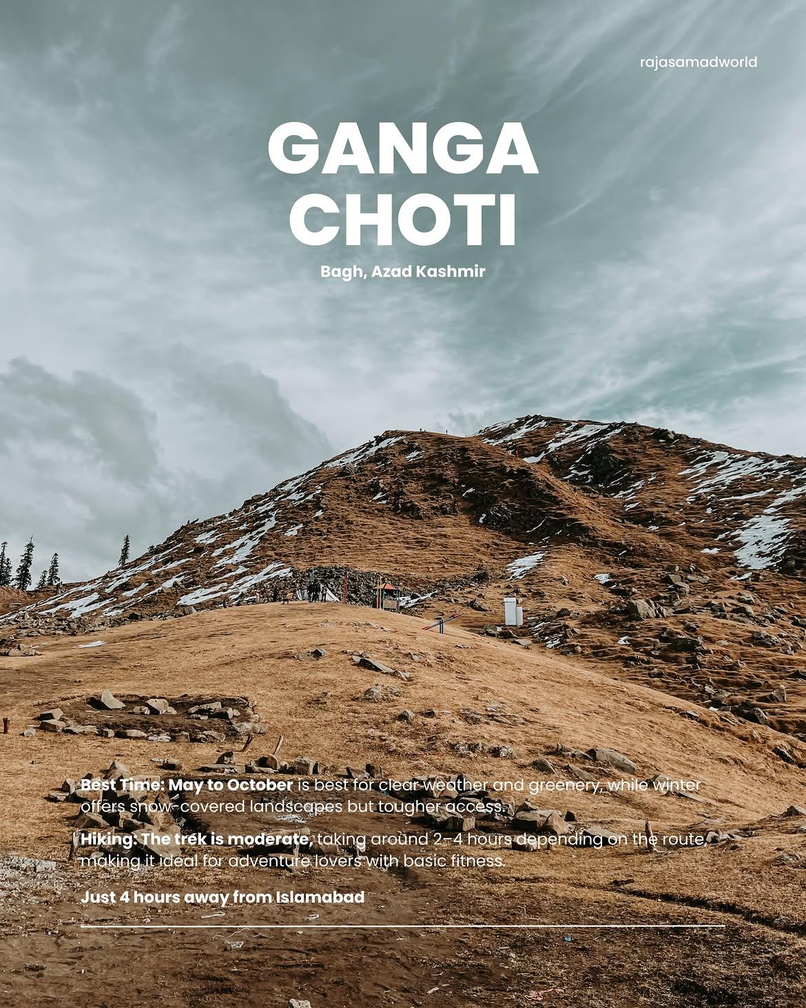
Ganga Choti
Ganga Choti (often referred to as the Crown of Bagh) is an iconic, dome-shaped mountain peak nestled within the scenic Pir Panjal Range of the Lesser Himalayas. Soaring to an elevation of approximately 3,045 meters (9,990 feet), this trail is highly famous for its sweeping green velvet meadows, vibrant alpine flowers, and its transition into a snow-covered wonderland hosting winter festivals during the colder months.
- Difficulty
- Moderate
- Distance
- 1.7km
- Elevation gain
- 286 m
- Duration
- 2h
- Best season
- May – Oct
The journey
Ganga Choti is a 1.7km moderate hike near Sudhan Gali. It climbs 286 m and takes about 2h.
Ganga Choti (often referred to as the Crown of Bagh) is an iconic, dome-shaped mountain peak nestled within the scenic Pir Panjal Range of the Lesser Himalayas. Soaring to an elevation of approximately 3,045 meters (9,990 feet), this trail is highly famous for its sweeping green velvet meadows, vibrant alpine flowers, and its transition into a snow-covered wonderland hosting winter festivals during the colder months.
Trail Statistics
Trail map
Elevation profile
Climb over the length of the trail. Tap or drag along it to read elevation and grade.
Weather
Five-day forecast at the trailhead, 2,745 m.
Today
6°5°
Tomorrow
17°4°
Precipitation 0.5
Sat
18°5°
Sun
18°6°
Precipitation 0.2
Mon
19°6°
Precipitation 0.2
Forecast from MET Norway, updated hourly.
Frequently asked questions
Can you camp overnight at Ganga Choti?
Yes, the summit meadows are suitable for camping and are particularly attractive for sunrise.
Is Ganga Choti good for a sunrise hike?
Yes, camping near the summit makes sunrise particularly worthwhile.
What can you see from the top of Ganga Choti?
Clear weather provides wide views across the Pir Panjal and surrounding Kashmir valleys.
Can Ganga Choti be visited in winter?
Yes, but snow can cover the route and winter ascents require suitable equipment and experience.
Can you drive all the way to Ganga Choti?
You can drive to the base area near Sudhan Gali, after which the summit requires hiking.
Trail gallery
Trail Photos
Photos from hikers
Recent shots from the community on this trail
No community photos yet. Been here? Add the first one.
Reviews
Ratings and recent conditions from the community
No reviews yet. Hiked this trail? Be the first to share conditions and help other hikers.