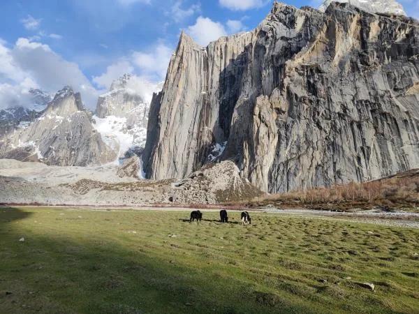
Nangma Valley
Nangma Valley is a 9.3 km trek in the Hushe Valley region of northern Pakistan with around 1,382 m of elevation gain.
- Difficulty
- Hard
- Distance
- 9.3km
- Elevation gain
- 1,209 m
- Duration
- 5h
- Best season
- Jun – Sep
The journey
Nangma Valley is a 9.3km hard hike in Hushe Valley. It climbs 1,209 m and takes about 5h.
Nangma Valley is a 9.3 km trek in the Hushe Valley region of northern Pakistan with around 1,382 m of elevation gain.
Trail Statistics
Trail map
Elevation profile
Climb over the length of the trail. Tap or drag along it to read elevation and grade.
Weather
Five-day forecast at the trailhead, 2,873 m.
Today
7°7°
Tomorrow
11°1°
Precipitation 2.9
Fri
11°5°
Precipitation 1
Sat
13°-2°
Precipitation 0.4
Sun
14°-1°
Precipitation 0.1
Expect roughly 6°C colder at the high point (3,836 m), before wind chill. Mountain weather turns faster than any forecast.
Forecast from MET Norway, updated hourly.
Frequently asked questions
Where does the Nangma Valley trek begin?
The trek begins from Kanday village in Ghanche District, accessible by road from Khaplu.
What makes the trail uniquely beginner-friendly compared to other Karakoram routes?
It offers massive, high-altitude alpine views and massive vertical walls within just a short 4-to-6-hour trek from a motorable road.
Which legendary vertical big-walls can climbers attempt only from this base?
Elite mountaineers use this valley to pitch expeditions up the notorious, hyper-steep faces of Amin Brakk, K6, and K7
Where can hikers go to see K2 without completing the grueling 2-week Baltoro Glacier trek?
Climbing up to Majrooh Top (4,900m) directly opposite the valley provides a direct line of sight to K2, Broad Peak, and the Gasherbrums
Why is this specific valley globally compared to Yosemite National Park?
The landscape is dominated by colossal, sheer granite walls like Amin Brakk that mimic El Capitan and Half Dome.
Can i do camping there?
Yes but you have to bring your own supplies; water, food etc as it is very remote.
Photos from hikers
Recent shots from the community on this trail
No community photos yet. Been here? Add the first one.
Reviews
Ratings and recent conditions from the community
No reviews yet. Hiked this trail? Be the first to share conditions and help other hikers.