Machulo La K2 Viewpoint Trek
- Difficulty
- Expert
- Distance
- 20.9km
- Elevation gain
- 2,005 m
- Duration
- 9h
- Best season
- Jun – Sep
The journey
Machulo La K2 Viewpoint Trek is a 20.9km expert-level hike in Ghanche. It climbs 2,005 m and takes about 9h.
Trail Statistics
Trail map
Elevation profile
Climb over the length of the trail. Tap or drag along it to read elevation and grade.
Weather
Five-day forecast at the trailhead, 2,465 m.
Today
10°10°
Precipitation 0.2
Tomorrow
15°8°
Precipitation 13.1
Fri
13°5°
Precipitation 7.1
Sat
17°3°
Sun
18°5°
Expect roughly 14°C colder at the high point (4,591 m), before wind chill. Mountain weather turns faster than any forecast.
Forecast from MET Norway, updated hourly.
Frequently asked questions
Where is the base for the Machulo La trek?
The trek begins directly from Machulo village in the Ghanche district near Khaplu.
Which major peaks can you see from the top of Machulo La?
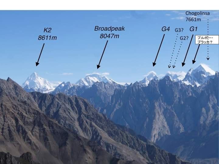
The summit ridge offers clear views of K2, Broad Peak, Gasherbrum I, Gasherbrum II, and Mashabrum.
How high is the viewpoint?
The summit/viewpoint sits at an altitude of approximately 5,000 to 5,200 meters (16,400 to 17,000 feet).
What is the ideal seasonal window for Machulo La?
Mid-June to late September provides the clearest skies and manageable snow conditions.
What is Machulo La?
It is a high-altitude ridge and viewpoint located above Machulo village in the Hushe Valley, District Ghanche, Gilgit-Baltistan
Trail gallery
Trail Photos
Photos from hikers
Recent shots from the community on this trail
No community photos yet. Been here? Add the first one.
Reviews
Ratings and recent conditions from the community
No reviews yet. Hiked this trail? Be the first to share conditions and help other hikers.