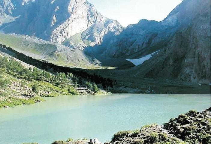
Shazor Lake
Shazor Lake is a 13.4 km trek in the Kumrat Valley region of northern Pakistan with around 1,390 m of elevation gain.
- Difficulty
- Hard
- Distance
- 13.4km
- Elevation gain
- 901 m
- Duration
- 6h
- Best season
- May – Oct
The journey
Shazor Lake is a 13.4km hard hike in Kumrat Valley. It climbs 901 m and takes about 6h.
Shazor Lake is a 13.4 km trek in the Kumrat Valley region of northern Pakistan with around 1,390 m of elevation gain.
Trail Statistics
Trail map
Elevation profile
Climb over the length of the trail. Tap or drag along it to read elevation and grade.
Weather
Five-day forecast at the trailhead, 2,627 m.
Today
6°5°
Tomorrow
13°-1°
Precipitation 0.2
Sat
15°6°
Sun
14°4°
Precipitation 4
Mon
16°3°
Precipitation 0.1
Expect roughly 5°C colder at the high point (3,442 m), before wind chill. Mountain weather turns faster than any forecast.
Forecast from MET Norway, updated hourly.
Frequently asked questions
Where exactly is Shahzore Lake located?
It sits at the very end of Upper Kumrat Valley on the border of Upper Dir and Chitral. The lake acts as the primary origin point for the Panjkora River
What is the altitude of the lake?
The lake rests at an elevation of approximately 11,400 to 11,900 feet (around 3,500–3,600 meters) above sea level
How do I reach the starting point of the trek?
You must travel by road to Thal village in Upper Dir, and then hire a 4x4 jeep to reach Dojanga (the last jeepable point in the Kumrat Valley)
Are there any accommodation or food facilities at the lake?
No. There is only 1 shephard hut midjourney but the area is entirely wild and untouched with no hotels, shops, or cellular service. Hikers must pack all self-sustaining dry rations, water filters, and camping equipment.
Can I cross over to Chitral from this route?
Yes. The lake sits right before the Thallo Pass (Thalo Zom), a demanding multi-day alpine pass that advanced trekkers use to cross over directly into the Sor Laspur / Bashqar Gol area of Upper Chitral.
Photos from hikers
Recent shots from the community on this trail
No community photos yet. Been here? Add the first one.
Reviews
Ratings and recent conditions from the community
No reviews yet. Hiked this trail? Be the first to share conditions and help other hikers.