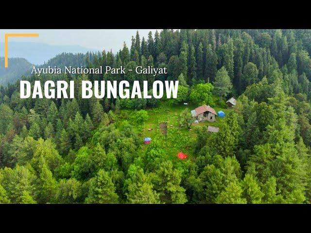
Dagri Bungalow Track
Dagri Bungalow Track is a 12.2 km trek in the Galiyat region of northern Pakistan with around 705 m of elevation gain.
- Difficulty
- Hard
- Distance
- 12.2km
- Elevation gain
- 767 m
- Duration
- 4h
- Best season
- May – Oct
The journey
Dagri Bungalow Track is a 12.2km hard hike in Galiyat. It climbs 767 m and takes about 4h.
Dagri Bungalow Track is a 12.2 km trek in the Galiyat region of northern Pakistan with around 705 m of elevation gain.
Trail Statistics
Trail map
Elevation profile
Climb over the length of the trail. Tap or drag along it to read elevation and grade.
Weather
Five-day forecast at the trailhead, 2,317 m.
Today
18°11°
Precipitation 3.2
Tomorrow
20°11°
Precipitation 1.6
Sat
21°11°
Precipitation 0.8
Sun
21°12°
Precipitation 0.2
Mon
21°12°
Precipitation 0.8
Expect roughly 4°C colder at the high point (2,924 m), before wind chill. Mountain weather turns faster than any forecast.
Forecast from MET Norway, updated hourly.
Frequently asked questions
Where does track start from?
The Dagri Bungalow trek primarily starts from Nathia Gali (via the Miranjani trail) or Thandiani, offering options for either a challenging 2-day overnight camping expedition or an intense, long single-day hike through dense pine forests.
What warning is inherently carried within the local name "Dagri" itself?
In the local dialect, "Dagri" roughly translates to "the home of leopards," hinting directly at the active wildlife sharing the surrounding sanctuary.
What is the altitude at bungalow?
The altitude at Dagri Bungalow is approximately 2,720 metres (8,924 feet) above sea level
What historical purpose did this trail serve long before it became a hiking route?
The path is an old Victorian-era mule track engineered by the British Raj to connect the military and administrative stations of Nathiagali and Thandiani.
Why is carrying an independent water purification or supply strategy absolutely critical?
The high-altitude forest ridge has very few natural water sources, requiring a fifteen-minute mountain descent just to tap the nearest hidden forest spring.
How does the atmospheric weather behave uniquely near the Qoona Dana meadow zone?
The high altitude creates a literal cloud trap, where thick, fast-moving mountain fog can reduce visibility to a few feet within mere seconds.
Why is attempting this trek as a single day-trip highly discouraged for average walkers?
The full route across Miranjani Top spans over 24 grueling kilometers out-and-back, demanding intense leg endurance that can easily cause exhaustion after dark.
Are there actual leopards there?
Yes very much so but there has never been a single recorded leopard attack on a hiker.
Photos from hikers
Recent shots from the community on this trail
No community photos yet. Been here? Add the first one.
Reviews
Ratings and recent conditions from the community
No reviews yet. Hiked this trail? Be the first to share conditions and help other hikers.