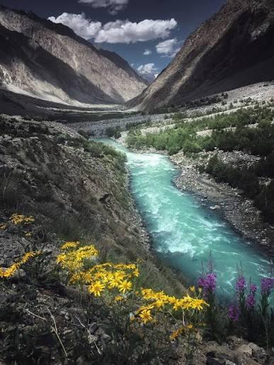
Dadrelli Pass (Swat To Ghizar)
- Difficulty
- Expert
- Distance
- 72.6km
- Elevation gain
- 8,466 m
- Duration
- 1d 15h
- Best season
- May – Oct
The journey
Dadrelli Pass (Swat To Ghizar) is a 72.6km expert-level hike in Swat & Kalam. It climbs 8,466 m and takes about 1d 15h.
Trail Statistics
Trail map
Elevation profile
Climb over the length of the trail. Tap or drag along it to read elevation and grade.
Weather
Five-day forecast at the trailhead, 24 m.
Today
22°21°
Tomorrow
31°16°
Precipitation 1
Sat
33°21°
Precipitation 0.7
Sun
32°21°
Precipitation 1.8
Mon
33°20°
Precipitation 0.4
Expect roughly 31°C colder at the high point (4,789 m), before wind chill. Mountain weather turns faster than any forecast.
Forecast from MET Norway, updated hourly.
Frequently asked questions
Is Dadrelli Pass suitable for a first-time high-altitude trek?
It is better suited to trekkers with prior experience on remote mountain routes.
Are there established camping spots along the Dadrelli Pass trek?
Camping is generally part of the expedition-style approach, with suitable spots depending on the route and conditions.
What makes Dadrelli Pass different from more popular Pakistani treks?
Its remote setting and comparatively limited tourist traffic make it more of an expedition-style trek.
Do you need a local guide for Dadrelli Pass?
A local guide is advisable because the route is remote and less frequently trekked.
What heights do we reach?
Dadrelli Pass is approximately 4,780 to 5,000 meters (15,700 to 16,400 feet) high.
Trail gallery
Trail Photos
Photos from hikers
Recent shots from the community on this trail
No community photos yet. Been here? Add the first one.
Reviews
Ratings and recent conditions from the community
No reviews yet. Hiked this trail? Be the first to share conditions and help other hikers.