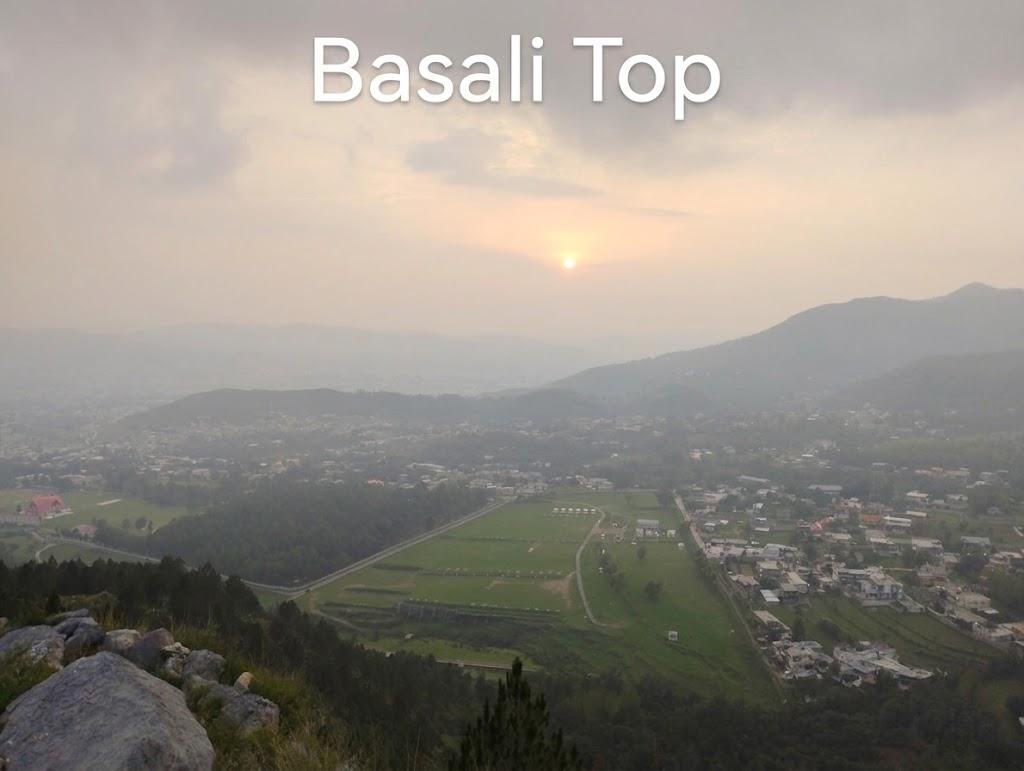
Basali Top
- Difficulty
- Beginner
- Distance
- 1.2km
- Elevation gain
- 75 m
- Duration
- 24min
- Best season
- May – Oct
The journey
Basali Top is a 1.2km beginner-friendly out-and-back hike in Abbottabad. It climbs 75 m and takes about 24min.
Trail Statistics
Trail map
Elevation profile
Climb over the length of the trail. Tap or drag along it to read elevation and grade.
Weather
Five-day forecast at the trailhead, 1,520 m.
Today
16°16°
Precipitation 1.5
Tomorrow
22°15°
Precipitation 6.3
Fri
24°16°
Precipitation 0.4
Sat
24°18°
Precipitation 0.4
Sun
25°18°
Precipitation 1
Forecast from MET Norway, updated hourly.
Frequently asked questions
How is the top like?
Top is vantage point that offers 360° view of Abbottabad city as well as the Kakul PMA grounds, and the forested slopes leading toward Thandiani
Tell me about the trailhead
Trailhead can be approached via Ilyasi mosque. The road till the trailhead is ok and can be approached by car.
s the trail well-marked with signs or trail markers?
No, it is an informal local route made of grazing and village trails, so an offline GPS map or local directions are necessary.
Is this hike accessible during the winter months?
Yes, unlike higher Galyat peaks, it sits at lower elevation (~1,600 m), meaning it stays mostly snow-free and hikeable year-round.
Trail gallery
Trail Photos
Photos from hikers
Recent shots from the community on this trail
No community photos yet. Been here? Add the first one.
Reviews
Ratings and recent conditions from the community
No reviews yet. Hiked this trail? Be the first to share conditions and help other hikers.