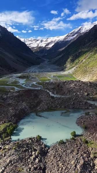
Handarap Lake
Handarap Lake is a 15.3 km trek in the Shandur region of northern Pakistan with around 1 m of elevation gain.
- Difficulty
- Easy
- Distance
- 15.3km
- Elevation gain
- 157 m
- Duration
- 4h
- Best season
- Jun – Sep
The journey
Handarap Lake is a 15.3km easy hike in Shandur. It climbs 157 m and takes about 4h.
Handarap Lake is a 15.3 km trek in the Shandur region of northern Pakistan with around 1 m of elevation gain.
Trail Statistics
Trail map
Elevation profile
Climb over the length of the trail. Tap or drag along it to read elevation and grade.
Weather
Five-day forecast at the trailhead, 3,044 m.
Today
9°4°
Tomorrow
12°-1°
Precipitation 0.5
Sat
16°4°
Precipitation 0.3
Sun
16°5°
Precipitation 1
Mon
17°5°
Precipitation 0.9
Forecast from MET Norway, updated hourly.
Frequently asked questions
What is the standard hiking time from the Handrap trailhead?
The steady ascent takes 4 to 6 hours from Handrap village along the glacial river gorge.
Is the trail clear or technically exposed?
It follows an unexposed shepherd track, featuring continuous incline over loose gravel and stone steps.
Is fishing permitted in the lake?
Yes, brown trout fishing is allowed provided you obtain a permit from the GB Fisheries Department.
What is the typical elevation gain on this trek?
Hikers gain roughly 1,000 meters of vertical elevation from the valley floor up to the basin.
Where is the best basecamp site along the lake?
The grassy meadows along the northwestern shoreline offer wind protection and freshwater runoffs.
Photos from hikers
Recent shots from the community on this trail
No community photos yet. Been here? Add the first one.
Reviews
Ratings and recent conditions from the community
No reviews yet. Hiked this trail? Be the first to share conditions and help other hikers.