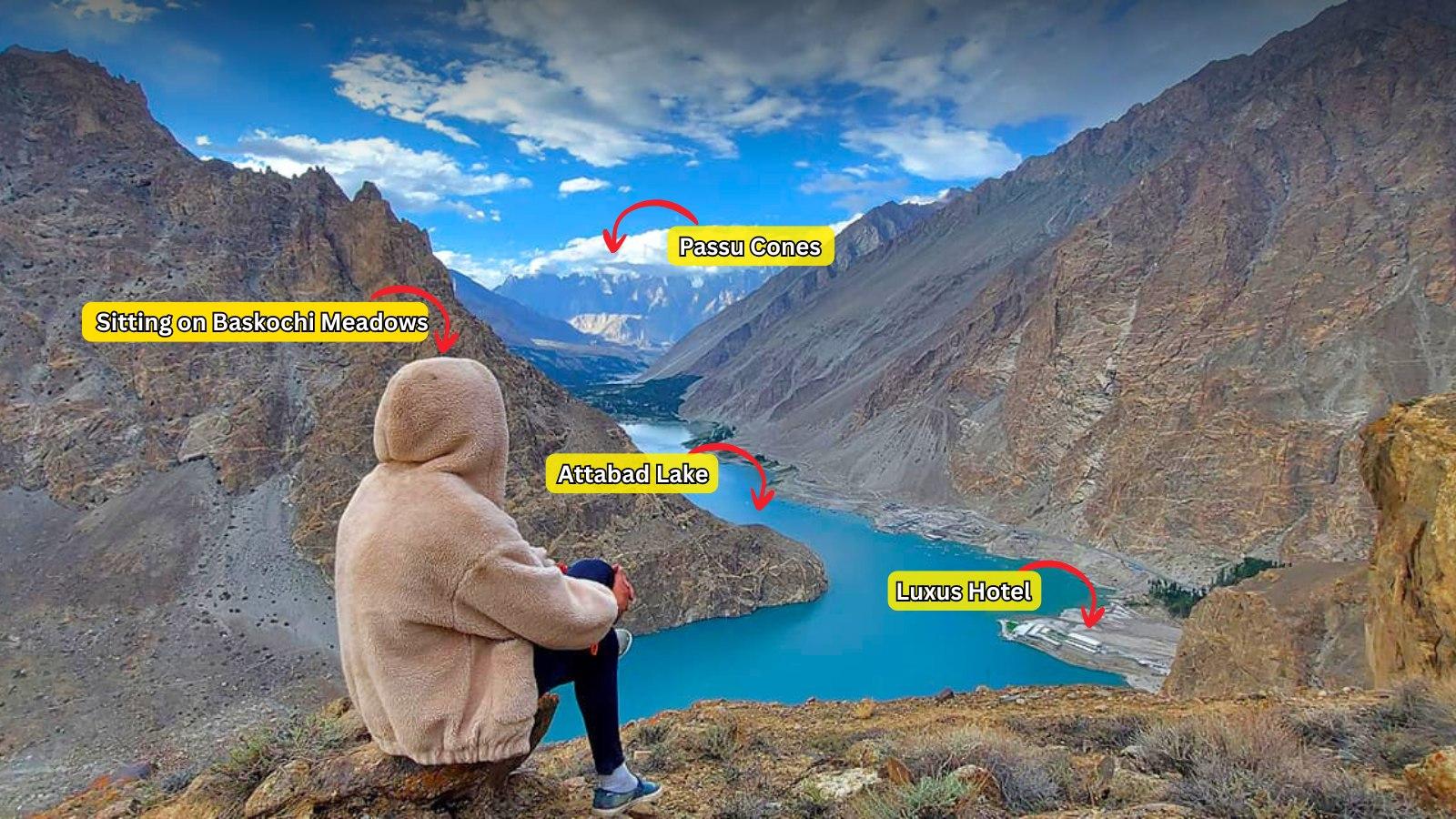
Baskochi Top
Baskochi Top is a 1.8 km trek in the Hunza & Nagar region of northern Pakistan with around 403 m of elevation gain.
- Difficulty
- Easy
- Distance
- 1.8km
- Elevation gain
- 443 m
- Duration
- 1h
- Best season
- Jun – Sep
The journey
Baskochi Top is a 1.8km easy hike in Hunza & Nagar. It climbs 443 m and takes about 1h.
Baskochi Top is a 1.8 km trek in the Hunza & Nagar region of northern Pakistan with around 403 m of elevation gain.
Trail Statistics
Trail map
Elevation profile
Climb over the length of the trail. Tap or drag along it to read elevation and grade.
Weather
Five-day forecast at the trailhead, 2,485 m.
Today
12°3°
Precipitation 3.2
Tomorrow
16°2°
Sun
16°6°
Mon
17°9°
Precipitation 0.1
Tue
16°8°
Precipitation 0.1
Forecast from MET Norway, updated hourly.
Frequently asked questions
Where exactly does the trail to Baskochi Top start?
The trailhead starts directly off the KKH right after exiting the long Attabad Lake tunnels on the upper bank
How is the track like?
The entire path is an unbroken, very steep incline over loose shale and gravel scree with zero switchbacks.
Is there any natural shade or running water on the slope?
No, the trail is completely exposed barren rock with no tree cover and no water sources; pack all fluids.
What views do you get from the summit.?
The top ridge delivers a direct view of the turquoise lake below framed against the distant Passu Cones.
What is the best time of day to make the ascent?
Early morning is best to avoid intense sun exposure on the bare cliffside and to catch calm water reflections.
Photos from hikers
Recent shots from the community on this trail
No community photos yet. Been here? Add the first one.
Reviews
Ratings and recent conditions from the community
No reviews yet. Hiked this trail? Be the first to share conditions and help other hikers.